Application of Magnetometer-Equipped Drone for Mineral Exploration in Mining Operations
Abstract:
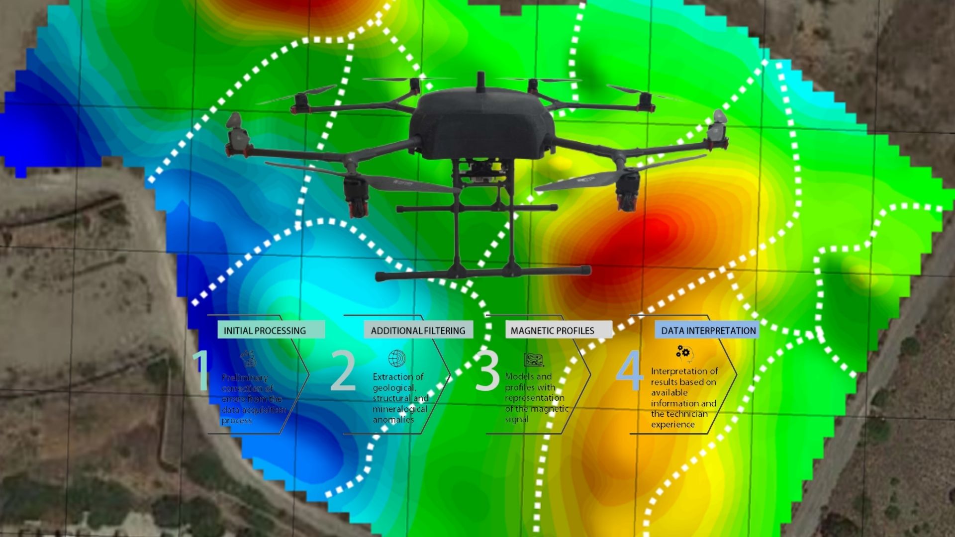
This study investigates the geological composition and material distribution within the Lavrion repository located in Greece through an aerial magnetometry survey using a novel aerial drone, CERBERUS, coupled with advanced data processing techniques. The deployment of drone-based magnetometry provided a high-resolution, non-invasive approach to capturing magnetic field data over complex and potentially hazardous terrain (soils highly contaminated), facilitating the rapid and precise mapping of the study area. As a final result, a 3D magnetic susceptibility model was developed, representing a detailed view of the magnetic susceptibility variations within the repository. This model enabled the comprehensive visualization of high-susceptibility zones associated with ferromagnetic materials and low-susceptibility zones correlating with diamagnetic materials like lead, arsenic, cadmium, and zinc. The combined methodologies underscore the effectiveness of drone-based aerial magnetometry in geophysical studies, highlighting its potential for mining exploration and waste management. This study demonstrates that the integration of drone technology with magnetic data processing offers a powerful tool for analysing subsurface structures in a safe, efficient, and non-invasive manner.
This article was written based on, among other things, research conducted and data collected during the Mine.io project.
Authors
Dimitris Perikleous [1,2], Katerina Margariti [1], Pantelis Velanas [1] , Cristina Saez Blazquez [2] , Pedro Carrasco Garcia [2] and Diego Gonzalez-Aguilera [2]
[1] ACCELIGENCE Ltd., 1066 Nicosia, Cyprus; dimitris.pericleous@accelligence.tech (D.P.)
[2] Cartographic and Land Engineering Department, Higher Polytechnic School of Avila,
Universidad de Salamanca, 37008 Salamanca, Spain