Environmental Management – Advanced Risk Assessment – session summary

Dr Vasileios Protonotarios, MSc is an active researcher/engineer/consultant for the last 24 years in the field of Environmental Technology, Waste Management and Chemical Engineering with special experience and skills in the field of solid waste management (including C&D and Hazardous Waste), recycling, soil remediation, brownfield site/quarries reclamation and risk assessment. He has conducted over 200 Environmental Impact Assessments (EIA), Life Cycle Assessments (LCA) and other Technical Essays for the Industrial Sector, Technical Companies, Public Authorities and individuals. He has 29 publications in peer – reviewed journals and international conferences and some 600 citations. Dr. Protonotarios has participated in more than 20 research projects as main researcher, most of them in the field of waste management, recycling and brownfields restoration. Finally, he possesses a significant experience in laboratory analyses and handling of Special Chemical Laboratory Equipment. In 2015 he founded ENVITERRA P.C. (MME), bringing together specialized engineers and specialist scientists, with a long-term study and scientific career. The main objective is to provide high level Technical Consultancy, Study & Research Services to Industries, Technical Companies, Public Sector, Universities (national and international), NGOs, private individuals etc.
1. Introduction
The current session focused on the effective Environmental Management of a hazardous waste repository (landfill) by exploiting Advanced Risk Assessment methodologies and tools. Waste deposited are coming from all the chain of mining and metallurgical industry (silver and lead production) at the city of Lavrion, Greece.
The main types of mining and metallurgical waste (MMW) include tailings (the fine waste material left after the extraction of minerals), waste rock (rock removed to access the ore) and Slag (by-products of metal smelting processes). It is well known that those wastes are related to specific environmental risks such as water contamination, soil contamination, air pollution, biodiversity loss and large-scale accidents (e.g. from failure of tailings dams, that can result in catastrophic environmental disasters).
The regulatory framework for the management of MMW is considerably strict. Environmental Impact Assessments (EIA) are required before new mining operations begin, and they include a detailed analysis of the environmental and social impacts of mining waste disposal. Permits and licensing demand that mining companies must comply with national and international environmental regulations, obtain the necessary permits, and adhere to waste disposal standards (such as European Union Directives or U.S. EPA regulations). Last, but not least, mines are required to have detailed plans for closure, including the management of mining waste and the restoration of disturbed landscapes.
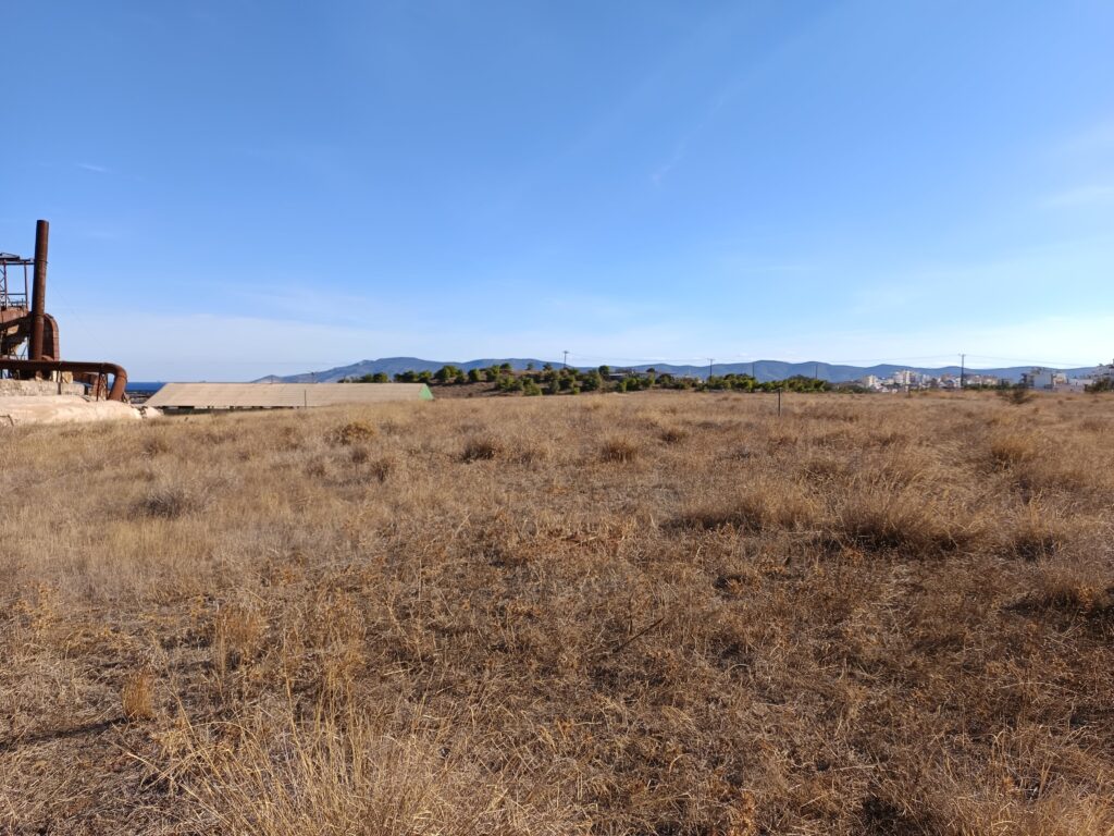
The repository under study is located within the borders of the Lavrion Technological & Cultural Park (LTCP) at the city of Lavrion, Greece. Lavrion is located at Lavreotiki peninsula on the south-eastern side of the Attika prefecture. Ancient Greeks started mining and metallurgy in the Lavreotiki area around 3.000 BC. During the 5th century BC, Lavrion used to be a large-scale silver mining and metallurgy centre, providing to the city of Athens the necessary wealth for its cultural development and military superiority.
In the modern times, Lavrion, despite of its small scale (about 10.000 habitants) has been one of the most important industrial centres in Greece during 19th and 20th century. It was built as a worker’s settlement, in the newly founded Hellenic State, partially following the “company town model”.
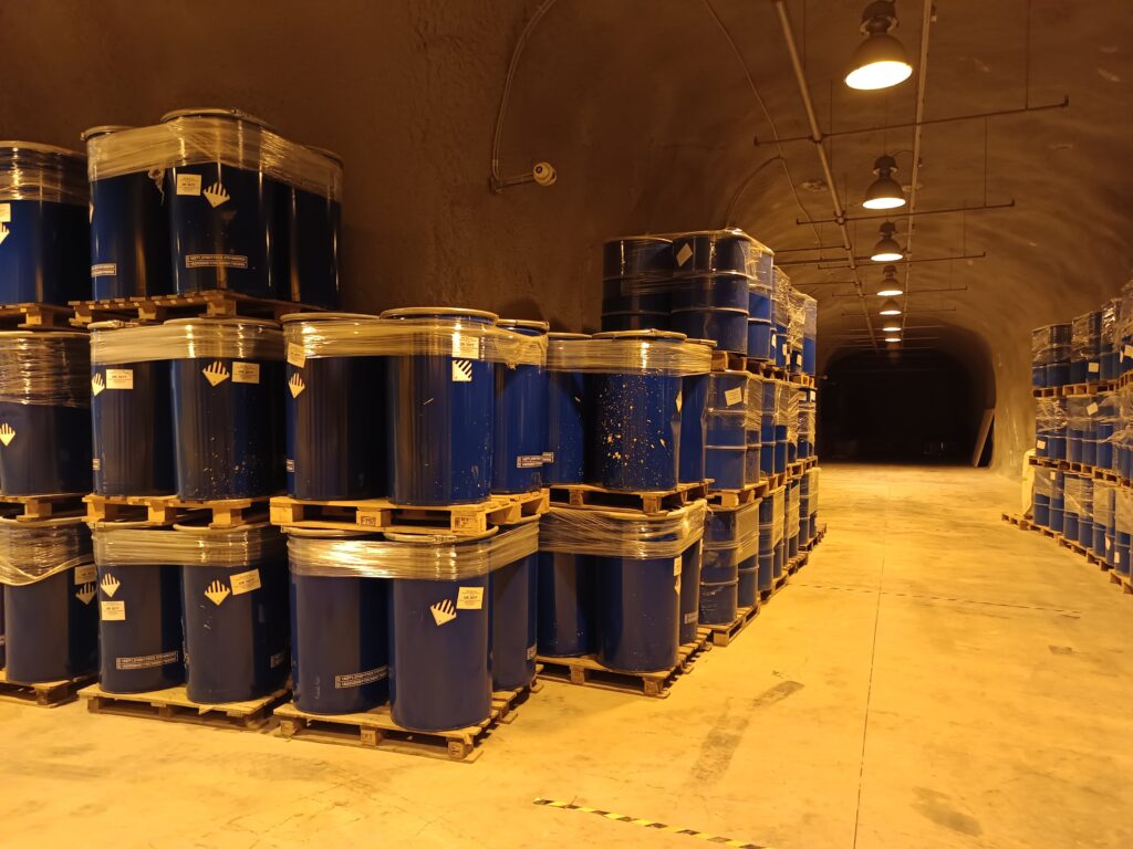
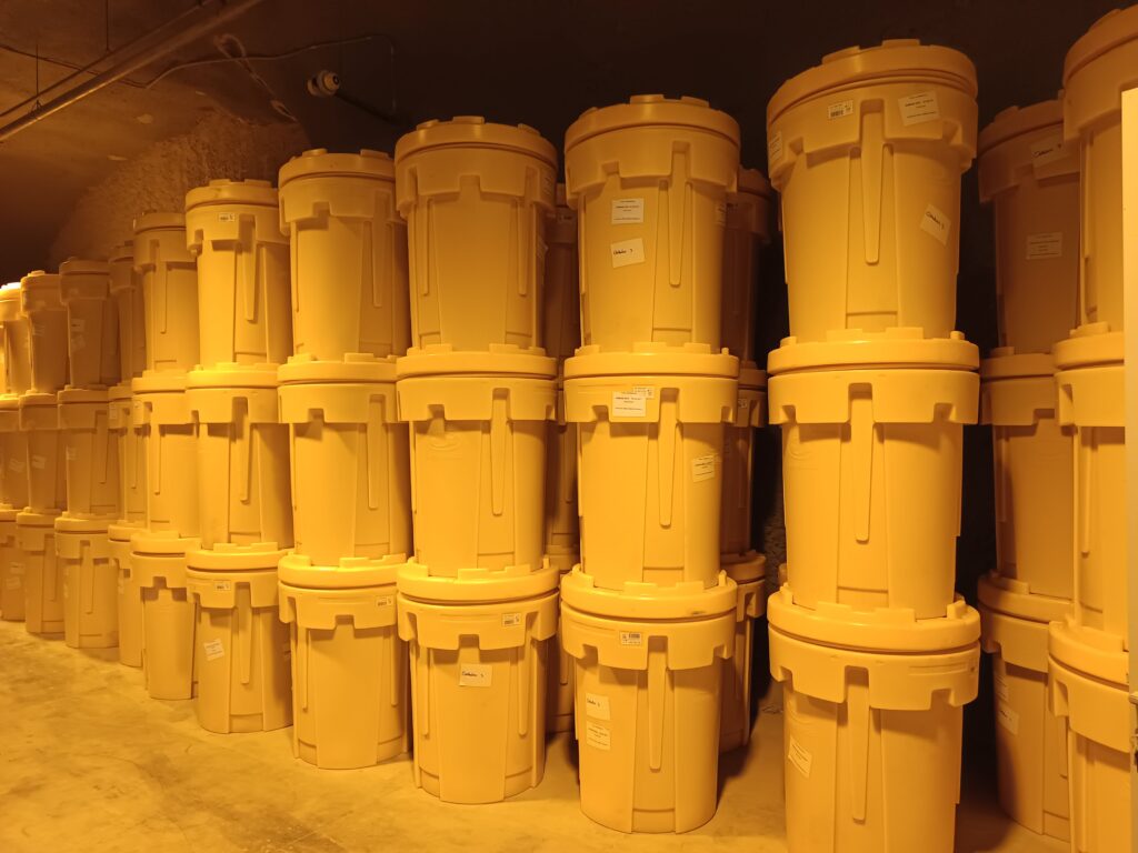
The metallurgical and mining industry, as it developed in the wider area of Lavreotiki, is considered, worldwide, perhaps the most important source of soil pollution, especially regarding heavy metals. The Waste Repository was constructed some 20 years ago so as to isolate a significant portion of heavily polluted soils from the general environment. The site was constructed on the basis of the “dry tomb”.
The main features of the Repository include:
- Some 130,000 m3 (estimated mass of almost 300,000 tons) of polluted soils contained (Clean-up area of 50,000 m2)
- Configuration of a selected area within the borders of LTCP as a landfill site (18.000m2)
- Dumping of soils within the landfill site
- Main pollutants include Pb, As, Cd, Zn, Cu, Mn and Fe in different compounds (e.g., oxides, sulphides etc.)
The repository has been engineered as following (lower to upper levels)
- 4.5 mm thick protective non-woven polypropylene geotextile (800 gr/m2)
- 0.8 mm thick (dry/wet) Geosynthetic Clay Liner (GCL) consisted of bentonite layer placed between 2 geotextiles with a hydraulic conductivity of 1.0×10⁻¹¹ m/s
- mm thick double-sided textured high density polyethylene geomembrane
- 10.0 mm thick 100% HDPE geosynthetic drainage layer
- Non-woven polypropylene geotextile (250 gr/m2)
- 1.0m thick top soil
Soils within the repository typically include concentrations of iron, lead, and zinc in the order of % (greater than 10,000 mg/kg), concentrations of arsenic, copper, manganese and cadmium ranging from 0.1 to 1% and lower concentrations of antimony and molybdenum.
The project cost a total of 3.500.000€, which corresponds to approximately 27 €/tn or 32€/m3 and it is considered significantly cost-effective, bearing in mind other soil remediation methods (biological, chemical, thermal etc.)
The main advantages of the repository, as a remediation approach, include:
- Minimize health hazards (i.e., cut the pathways via which the hazards are transmitted)
- Allow the safe use of the site for recreational purposes
- Facilitate the reverse process in which the wastes could be mined and used as valuable materials in the future
On the other hand, the main drawbacks related to the Repository are:
- Pollutants remain in the area without reducing their concentration
- The difficulty of calculating the time of effective protection is multiplied in relation to the cover, since in addition to the top cover, the underlying waterproofing of the waste must be monitored.
- The maintenance/repair of the waterproofing layer, especially in case of damage, is a difficult and expensive process and practically requires re-excavation and transport of waste
- Significant limitations arise in the future uses of the land, especially when it has to be taken into account in geotechnical calculations, in addition to the surface layer and the underlying waterproofing.
Considering the abovementioned remarks, a complex situation arises in the case of contaminated mined sites, having serious economic, environmental, social, and political implications. On the one hand, there is the need to protect human health and ecosystems from harms related to past mining activities at an affordable cost for the society. On the other hand, remediation measures should be implemented in a way that would allow for the potential ‘ore’ to be mined in the future. In such cases, a risk-based approach may be quite effective in providing an environmentally sound and economically viable solution without jeopardizing the opportunity to recover valuable resources in the future from today’s waste.
Risk-targeted methodologies examine the chain of “Hazard →Pathway → Target” and aim to break the links. In this way, risks can be managed in many ways, e.g., they can be eliminated, transferred, reduced, encapsulated, or retained with respect to an acceptable risk level taking into consideration critical factors of the problem under investigation (e.g., environmental pollution, finance, regulation, social effect, etc.).
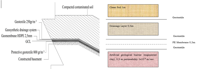
Figure 1: Repository Cover and Bottom Structure
2. Risk Assessment Analysis/The Repository Construction Philosophy
In recent years, risk assessment and risk management techniques are increasingly being used to deal with environmental issues. In broad terms, risk assessment is carried out to examine the effects of an agent, estimated either quantitatively or qualitatively, on humans (Human Risk Assessment) and ecosystems (Ecological Risk Assessment). Risk management is defined as the process of evaluating and selecting appropriate regulatory or remedial alternatives. Thus, contrary to soil standards that focus solely on soil remediation, risk assessment and management techniques may prove to be helpful in limiting risks to human health and the ecosystem to acceptable levels at an affordable cost.
The initial approach for the risk assessment analysis follows the current U.S. Environmental Protection Agency guidance for conducting human health risk evaluations which is widely accepted and used for more than two decades. The objective of the risk assessment analysis was to estimate the risks posed by the contaminated soil to the affected population, in order to define a cost effective, risk-based remediation scheme.
The case study risk assessment is performed in a step-by-step format, which is divided in four fundamental parts:
a. data collection and hazard evaluation
b. exposure assessment
c. toxicity assessment
d. risk characterization
(a) Data Collection and Hazard Evaluation: In this step all the available data for the site are gathered and analyzed to identify risk sources, specific hazardous substances, etc. Focusing on soil, seven metals and metalloids (arsenic, cadmium, lead, copper, iron, zinc, and chromium) were selected for risk evaluation, because of their concentration, frequency of appearance, and the available toxicity parameter values.
(b) Exposure Assessment: The exposure assessment focuses on estimating a substance dose (chronic daily intake in mg/kg-day) to which individuals are exposed or are about to be exposed. The pollutant linkage is evaluated, in terms of the pathways, the routes of exposure, frequency, and duration of exposure and the susceptible population, based on the current and future land use scenario.
(c) Toxicity Assessment: Toxicity assessment refers to dose-response evaluation. Toxicity values are used to describe the cancer and non-cancer health effects caused by differing levels of exposure (or doses) to a specific contaminant. Reference Dose (oral) and Reference Concentration (inhalation) refer to non-carcinogenic health effects, while Slope Factor (oral) and Unit Risk Factor (inhalation) refer to cancer health effects. Oral slope factor (SF) is an estimate of the increased cancer risk from oral exposure to a dose of 1 mg/kg-day for a lifetime. SF can be multiplied by an estimate of lifetime exposure (in mg/kg-day) to estimate the lifetime cancer risk. Inhalation unit risk (URF) is an estimate of the increased cancer risk from inhalation exposure to a concentration of 1 μg/m3 for a lifetime. The IUR can be multiplied by an estimate of lifetime exposure (in μg/m3) to estimate the lifetime cancer risk. Oral reference dose (RfD) is the amount of a chemical that one can ingest every day for a lifetime (mg/kg-day), that is not anticipated to cause harmful non-cancer health effects. Inhalation reference concentration (RfC) is the concentration of a chemical that one can breathe every day for a lifetime that is not anticipated to cause harmful non-cancer health effects. The RfC can be compared to an estimate of exposure concentration in mg/m3.
(d) Risk Characterization: The final step of the risk assessment process is to quantify the potential for carcinogenic impacts for all possible routes of exposure. U.S. EPA has established an “acceptable” cancer risk, expressing the probability of an individual developing any type of cancer if exposed to carcinogenic agents during his or her lifetime, equals 1.0 x 10⁻⁶ (see Figures 2 and 3). Based on the concentration of pollutants in soil, the Risk if the repository didn’t exist was estimated (Figure 4).
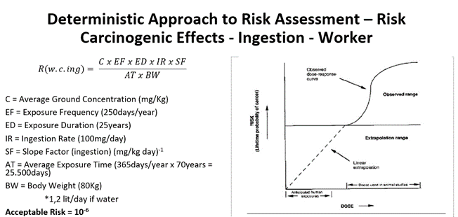
Figure 2: Risk Assessment approach considering workers as a target population (parameters used and dose – response relationship for carcinogenic effects)
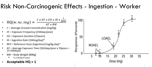
Figure 3: Risk Assessment approach considering workers as a target population (parameters used and dose – response relationship for non-carcinogenic effects)
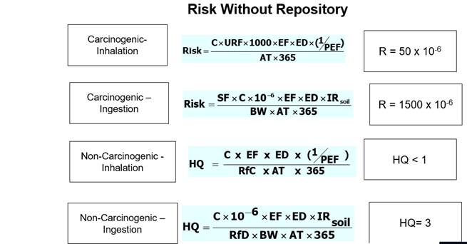
Figure 4: Risk Characterization Results (without the repository scenario)
3. Main Risks involved in the current Repository Status and the Mine i.o. Approach
Considering the current Repository conditions, the main risks involve:
- Stability of the embankment
- Status of the isolation measures
- Water intrusion on the waste mass
- Hazardous Metals/Metalloids escape from surface or underground
- Surface status (topsoil layer and geotextile)
- Groundwater Status
On the other hand, some critical issues to be covered are related to: a) the distribution of metal compounds within the waste mass and b) balance the risk and the benefits if metal exploitation is considered.
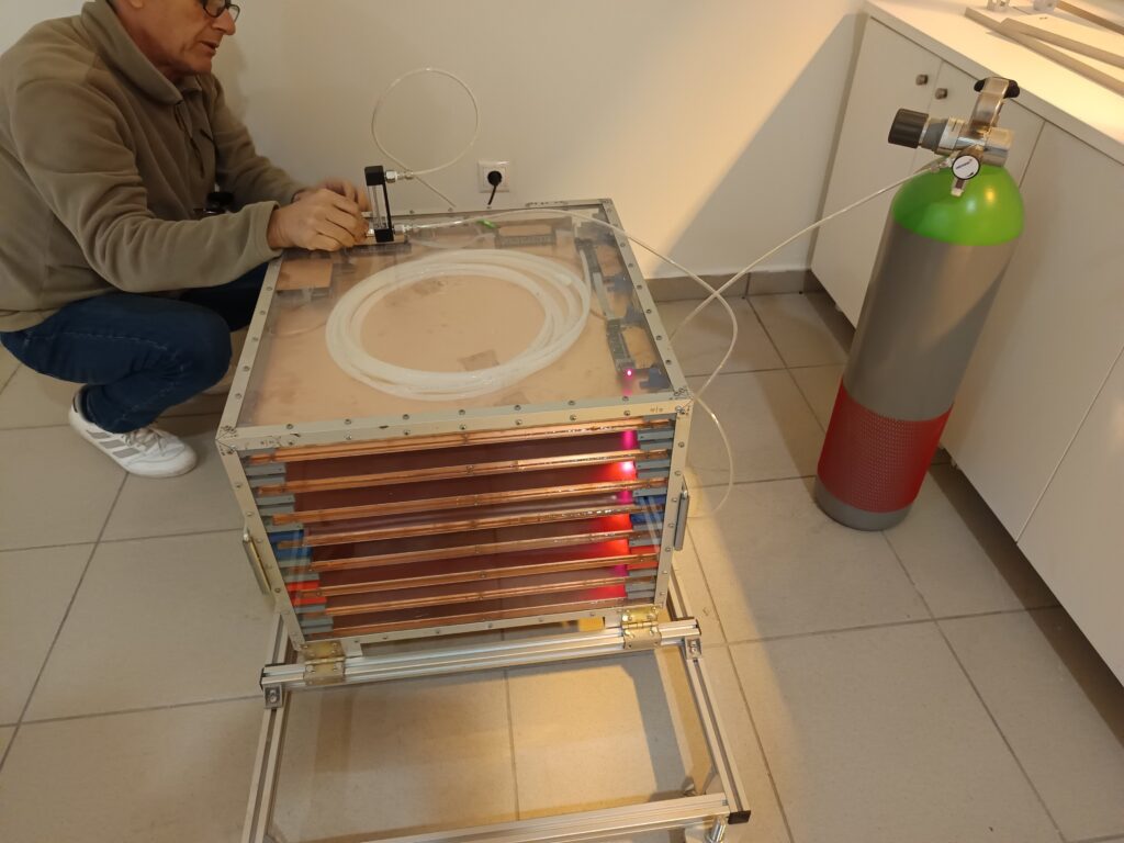
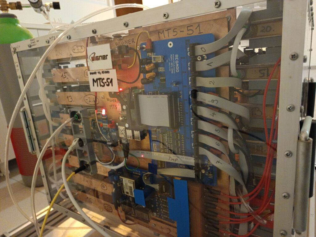
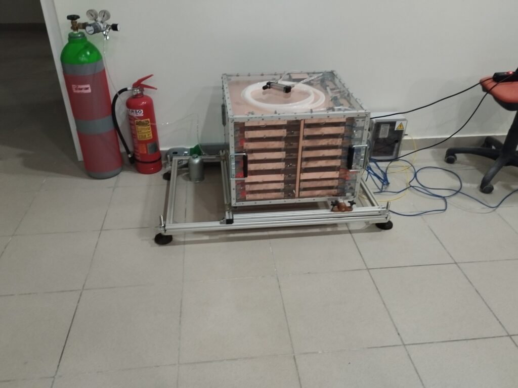
The Risk Assessment approach for the current and the future status of the Repository is based on the evolution of the Mine i.o. Project. Repository is considered one of the Pilot Sites, where the Mine i.o. concept is implemented. The main features of that approach include (implemented by USAL and ACC with the support of the Pilot owner AMDC):
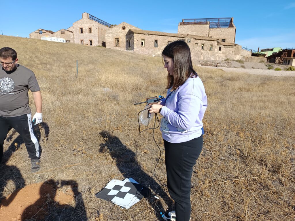
- Differential Interferometry Synthetic Aperture Radar (DInSAR) offers a unique advantage for assessing hazardous waste landfills by providing real-time, precise monitoring of ground deformation and structural stability. It supports proactive risk management, allowing landfill operators to identify and address potential issues before they escalate, thus reducing environmental and health risks associated with hazardous waste containment.
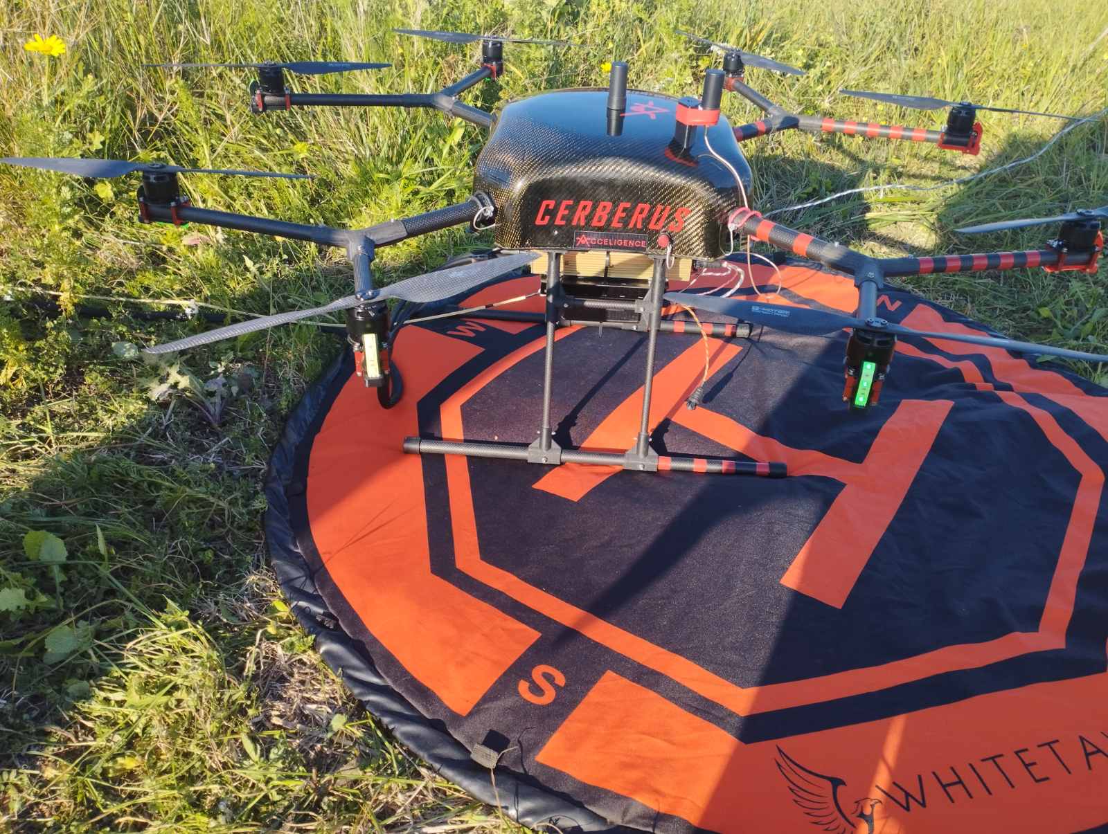
- Using drone-mounted magnetometers for hazardous waste landfills provides detailed, non-invasive data that aids in understanding the spatial distribution and concentration of waste. By integrating this data into environmental risk assessments, operators and environmental consultants can better understand the potential threats posed by the landfill, prioritize areas for remediation, and reduce health and environmental risks.
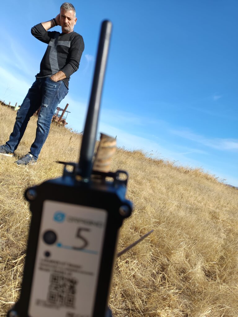
- Ground Penetrating Radar (GPR) provides essential data for assessing risks at hazardous waste landfills by revealing hidden structures, detecting potential contamination pathways, monitoring landfill stability, and supporting gas management. By identifying and characterizing subsurface features and potential hazards, GPR plays a critical role in mitigating environmental risks, informing remediation, and ensuring the safe, sustainable management of hazardous waste sites.
- Light Detection and Ranging Simultaneous Localization and Mapping (Lidar Slam) provides a powerful tool for assessing risks in hazardous waste landfills by delivering precise, actionable spatial data. Successful implementations depend on the integration of robust hardware, advanced SLAM algorithms, and effective data interpretation strategies to guide both immediate safety interventions and long-term environmental management.
The main results of the Mine i.o. approach to Risk Assessment in the Repository are summarized below: (Figures 5-8).
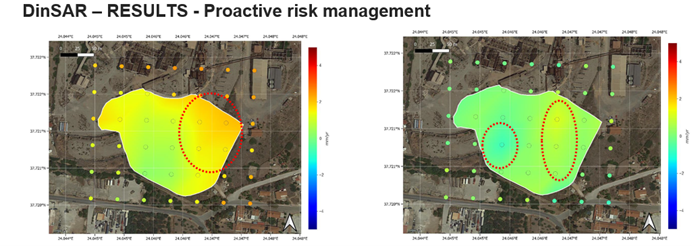
Figure 5: DinSAR results
Results show a higher risk of vertical movement in the orange zones, especially at the east and northeast. Less evident (maximum of 1mm/year), an area to the northeast with positive velocities, and at the west of the center, with negative velocities
The zones with high values are probably related to areas of higher concentration of ferromagnetic materials, such as iron.
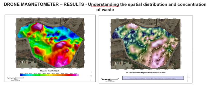
Figure 6: Drone-mounted magnetometers results (1)
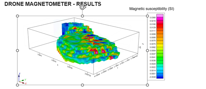
Figure 7: Drone-mounted magnetometers results (2)
Negative low susceptibility values correspond to areas where there is a higher proportion of materials with a low content of ferromagnetic materials and diamagnetic ones such as lead, arsenic, cadmium and zinc.
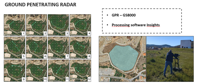
Figure 8: GPR results
The preliminary results show the location of the first layer of geotextile, which was originally placed at a depth of 1 m. This layer is found with quite significant continuity in some areas of the structure. However, more altered areas are found, where the first layer of geotextile distributed in variable depth, showing altered areas with possible accumulation of water and mixing of the horizons of vegetal soil and layer of drainage material.
4. Future Work
For purposes of completing the Risk Assessment approach by implementing the Mine i.o. Solution, the following steps are essential:
- Monitoring humidity in the mining deposit at different strategic points.
- Correlation of humidity measurements with ground-penetrating radar results to determine the status of deeper insulation layers.
- Integration of all technologies and definition of the remediation techniques to be used, as well as the possible routes for recovery of potential minerals
- Quantify the risk by:
- Estimating rate of deformation
- Define the degree and rate of slope movement
- Performing precise risk zoning, helping prioritize high-risk areas
- Identifying high-risk zones for leachate
- Locating potential leachate pathways
- Leakage Quantification
- Detailed assessment of cap and liner condition
Let us know what you think in the comments and share your thoughts with us!

Leave a Reply